Rift Valley Line and Eastern Coastal Route
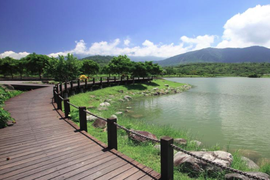
Dapo Lake
Dapo Lake
Dapo Lake is a valley formed by the Central Mountains and Coast Mountains. The lake water flows towards north, and is one of the sources of Siouguluan River, as well as the major wetland in the East Rift Valley that serves as a bastion to ecological conservation. After being redesigned, it is now transformed into a water park that is ideal for hiking and cycling.
Guanshan Water Park
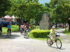
Guanshan Water Park is the first environmental park built using funds acquired from air pollution tax. Covering about 32 hectares, the park is planned into a water park with rustic atmosphere. By utilizing the Sinwulyu River, it can be used for various leisure activities such as garden tour and cycling.
Luye Paragliding Area
Luye Paragliding Area is located above the narrow valley in the intersection of the Central Mountains and Coast Mountains. The attraction is a must-go for adventurous tourists who want to experience the exhilarating sport paragliding and hot-air balloon.
Chulu Ranch
Covering about 70 hectares, Chulu Ranch is the largest slope ranch in Taiwan. The cattle feed on high quality grass and drink underground spring water taken from the Central Mountains, making their exceptionally delicious. In addition to the large tract of grassland, one can also get a gorgeous view of the Dulan Mountain.
Basian Cave
Basian Cave of the Changbin Township is famous for it's geological landscape and prehistoric sites. With a unique landscape of sea caves and entrance to sites of the prehistoric Changbin Culture, Basian Cave is classified as a first-class national historical site. It is also geographically the northern-most tourist spot in Taitung County.
Sansiantai Scenic Area
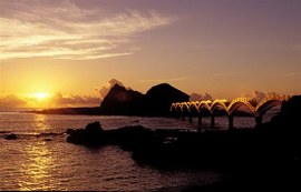
Sansiantai Island is covered with rare rocks, among which the three huge rocks are rumored to be the evidences that Lu Tung-pin, Li Tie-guai and Ho Hsien-ko of the Eight Immortals of ancient Figures were once on this island in the folk legend, hence the name Sansiantai (pronounced as" the island of three immortals" in Chinese).
East Coast National Scenic Area Administration
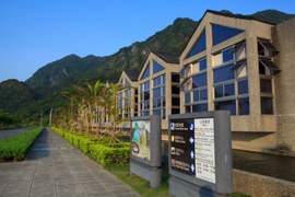
The entrance of the East Coast National Scenic Area Administration is an art sculpture called "The Solemn Pledge of Love" that symbolizes aboriginal culture and the views of mountains and seas. On the left area of the entrance, the Ami Indigenous Culture Art Center covers about two hectares, and the traditional ritual houses and dwelling houses in this center are rebuilt based on the historical data. Moreover, there is an outdoor arena that can accommodate a thousand people.
Chenggong Fishing Port
Xingang Fishing Port, also known as Chenggong Fishing Port, is the most important and the largest fishing port on the eastern coast. Famous for it's fresh seafood and dried fish, it is one the few fishing ports that can provide "catch of the day".
Jinzun Island Beach
Jinzun Island is the only land-tied island that is in the process of forming in Taiwan. It possesses high academic value. The whole range of this area includes Jinzu Fishing Port, White Sand Bay and the mountain streams and wineglass-shaped bay, hence the name "Jinzun" (pronounced as the "golden wineglass" in Chinese). Moreover, owing to the anchor-like shape, it is also known as "Anchor Island" or "Anchor-Shaped Reef".
Siaoyeliou
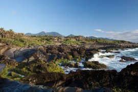
Siaoyeliou is located in the sea area in the north of Fugang Fishing Port, and it is the southernmost landscape spot on the eastern coast. Due to the similar types of geography. rocks and the appearance with Yeliou in the northern of Taiwan, it is called "Siaoyelioi" (means the little Yeliou in Chinese)
Source of Article: Taitung County Government
| City | Taitung County |
| Contact Information | East Coast National Scenic Area AdministrationTel: 089-841520 SiaoyeliouTel: 089-281136 |
| Location | Taitung County |
| Transportation | East Coast National Scenic Area AdministrationAddress: No.25, Sinchun Rd., Sinyi Borough, Chenggong Township, Taitung County, Taiwan (R.O.C.) SiaoyeliouAddress: the north of Fugang Fishing Port, the sea area around the Provincial Highway No. 11 at 162k mark. |
comments powered by Disqus

